Let's fly into the future of roof measurement
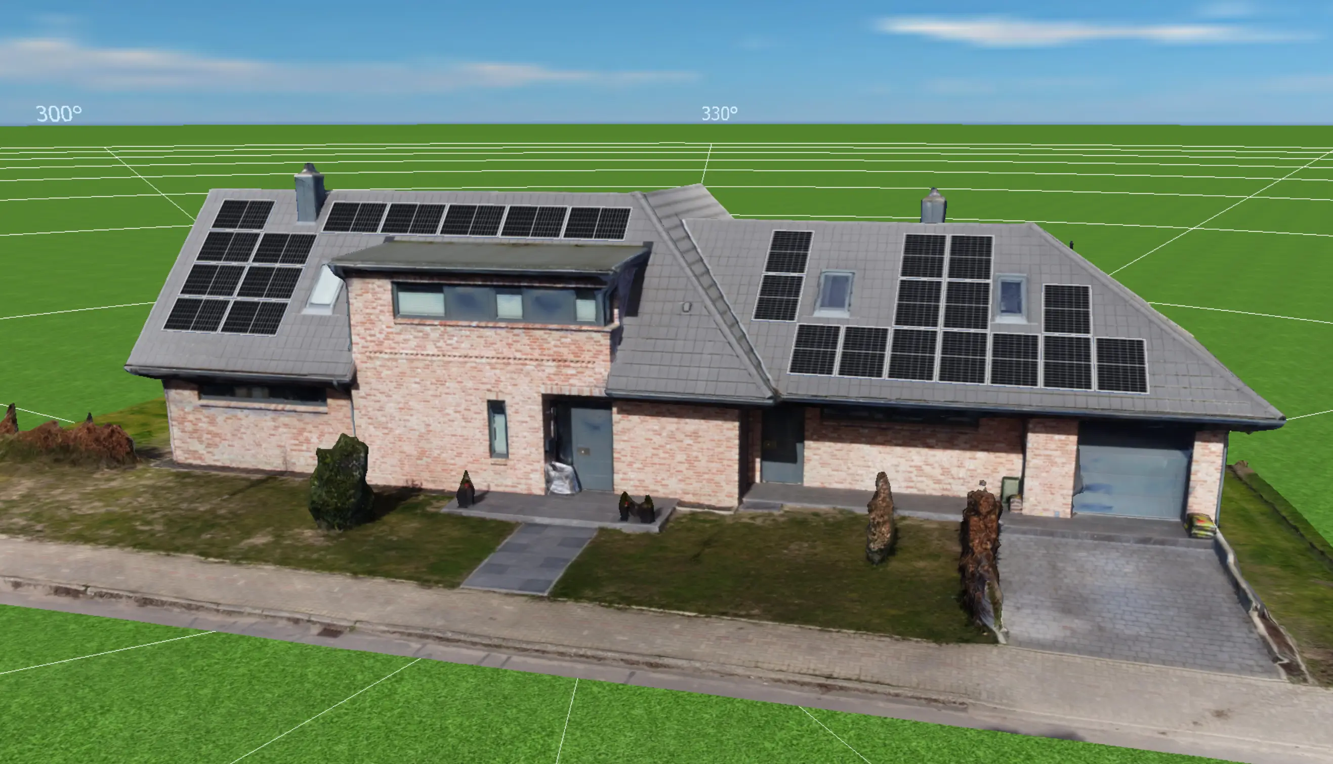
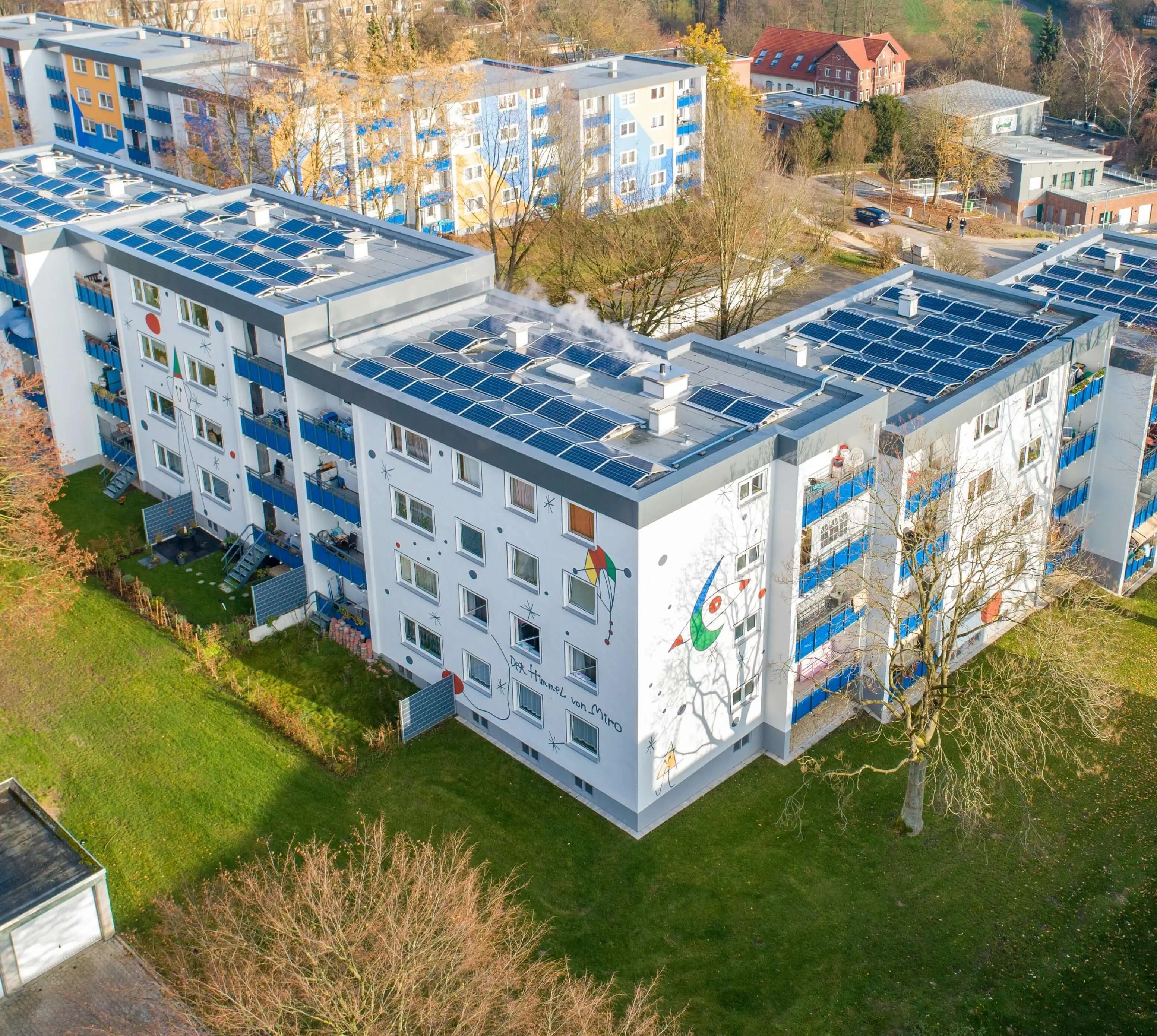
Get a detailed 3D model quickly and inexpensively: We turn drone images into precise 3D models and exact roof measurements with our innovative photogrammetry service!
* The basic fee for calculating the first project after registration is waived once. Booking additional services may incur costs.
Process
It's that easy
In 3 simple steps to your own 3D model.
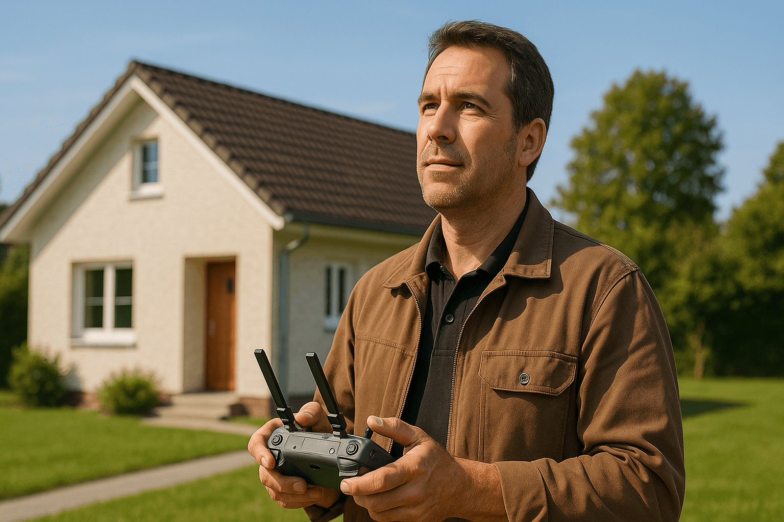
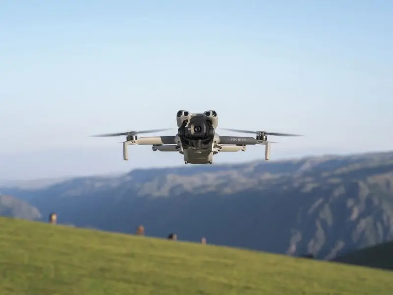
Step 1: Capture object
Fly over the object with your drone and take pictures from different angles. You can find the exact procedure in our checklist.
Do you have a DJI Mini 3/4 Pro or DJI Air 3S? Perfect! In this case, the drone flies on its own.
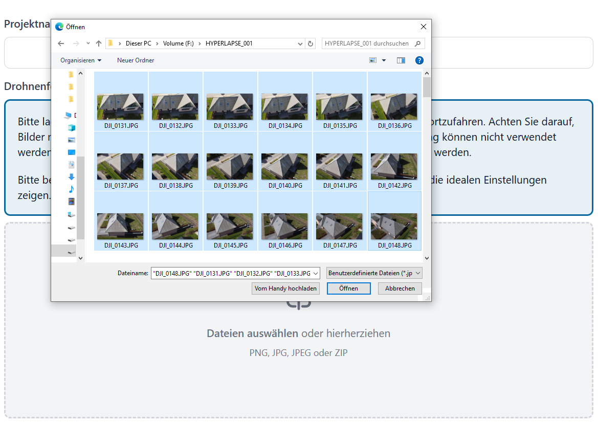
Step 2: Upload pictures
Upload your pictures to our website. Our software then automatically creates a complete 3D model of the building, and our experts may make necessary corrections.
On average, the processing takes less than 2 hours.
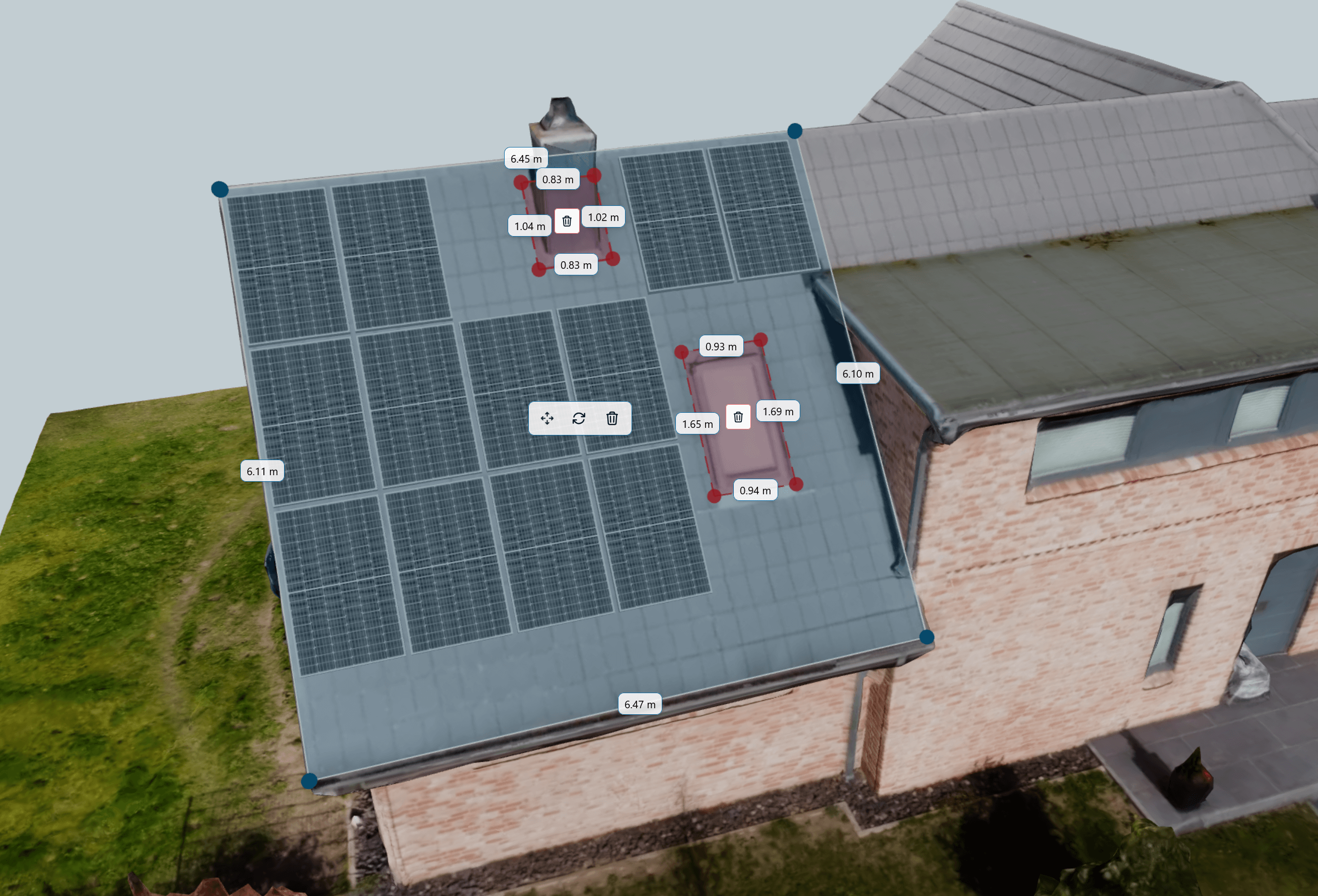
Step 3: Measure and plan
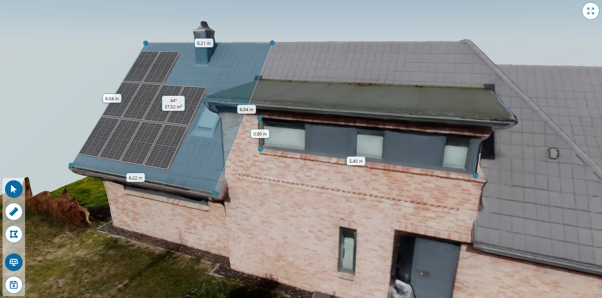
Import our export formats into your preferred planning software, or plan and measure directly in our online viewer - directly usable on PC, tablet or mobile phone.
Product
Your advantages
- Time saving
- A survey flight with the drone lasts an average of 10 minutes. Leave your ruler at home.
- Cost cutting
- Because the survey flight requires less time and manpower, the costs are lower compared to manual surveying - especially for complex roofs.
- Accurate
- Our photogrammetry service delivers highly precise results. Evaluate directly on your computer - no measurement is forgotten.
- Safe
- GPS-controlled drones with obstacle detection do not fall from the roof and thus minimize the risk for your employees and customers.
Product
Our services
- Files
- By default you get a high-precision textured 3D model, for example as a .obj, .glb and .dae file. If requested, we can also produce point clouds, CAD models and reports.
- Integration
- Easy integration into your existing workflows, including optimized exports for use in PV*SOL and SunnyDesign.
- Speed
- On working days, the 3D model is available for further processing within a few hours.
- Online viewer
- Measure areas and distances directly in the browser, place solar panels on the model and share the configuration with your partners and customers.
- Service
- We will be there to help you with any questions you may have - right from the start. You can reach us around the clock, both by phone and in writing.
Pricing
Transparent pricing.
The costs are calculated based on the floor area of the house. When you upload the drone footage, you will see the estimated price.
No monthly fee or contract period, starting at just €25 per project.
Standard
from 25€ per project
plus 19% VAT
25€ for up to 1000m² footprint, +20€ per additional 1000m².
Perfect for single and multi-family homes as well as medium-sized business premises.
- Complete 3D model
- Online viewer with built-in measurement
- Additional export formats upon request
- 24/7 Support
- Monthly billing
- Payment by credit card, PayPal, SEPA or invoice*
- *for business customers
Our start package
€1,048.74
zzgl. 19% USt., zzgl. Versand
- DJI Mini 5 Pro Fly More Combo - automated surveying flights in less than 5 minutes, ideal for areas up to 2000m²
- Includes replacement batteries and practical carrying bag
- Ready to fly - updates installed, batteries charged, hardware checked
- No drone driving license necessary, thanks to 249g and C0 certification
- Including 1 month of free 3D model processing
FAQ
Frequently asked questions
Here we answer the most frequently asked questions and provide tips from our many years of experience. Your question is not listed? Feel free to Contact Us, we're happy to help!
2) After signing up, log in and create a new project. Upload the drone images of the desired project into the interactive input mask. These should be taken from different angles to enable precise photogrammetry. Please pay attention to the instructions in our handbook “The Perfect Survey Flight”
3) Our specialized software processes the uploaded images. It creates a 3D model of the roof based on the images and their GPS coordinates.
4) Once processing is complete, you will receive a notification. You can then download the finished 3D model from your SKYMODEL account.
- DJI Mini 2, Mini 3, Mini 4 (Pro) or Mini 5 Pro
- DJI Air 2S, Air 3S
- DJI Mavic 2, Mavic 3, Mavic 3E/T
- DJI Matrice 4E/T
- DJI Phantom
- DJI Inspire
If you have any further questions, we are available at any time. We would also be happy to advise you on purchasing the right drone for your individual requirements.
We can also provide orthophotos and vector files upon request.
A video guide will follow in the future.
Contact
Interested? Contact us!
Are there any questions left unanswered? We would be happy to discuss everything else in a phone call or meeting.
About Us
Our drive.
With a deep-rooted respect for nature and an academic career in aerospace engineering at TU Dresden, I, Ben Besserdich - 24 years old, founded SKYMODEL Photogrammetry. My specialization in spacecraft power systems, including photovoltaics and simulation software, has inspired me to develop innovative solutions for the solar industry.
As someone who is at home in the great outdoors, whether hunting or Fishing, my personal concern is to preserve the environment for future generations. This passion led me to renewable energies and motivated me to pursue the path of solar energy.
The experience I gained when I wanted to take over the PV planning for my parents' house and recognized the complexity of the process, was the turning point for me. This challenge gave rise to SKYMODEL Photogrammetry, founded with the aim of revolutionizing the planning of photovoltaic systems.
Today we work with customers from all over Germany and have made it our mission to actively shape the energy transition. Our high-precision 3D models, which we deliver quickly and reliably, make PV planning easier for all types of buildings. We are available to our customers at any time to answer their questions and guide them through the planning process.
SKYMODEL Photogrammetry stands for precision, efficiency and customer proximity - values that come into play in every phase of our work and that drive us to make a sustainable contribution.